Coming with new maps useful for treks in Sahyadris
Earlier in 2012, I wrote a blog post about maps in Sahyadris http://ontheedgeofsahyadris.blogspot.com/2012/02/useful-maps-for-treks.html
These were hand drawn maps(that time, Google maps were not much popular)
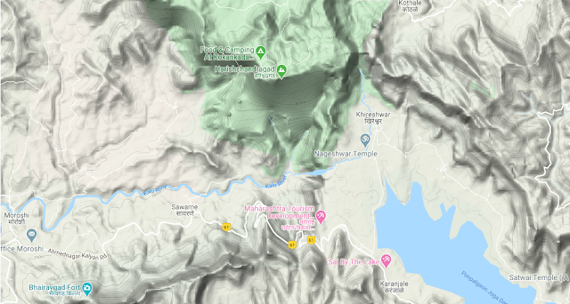
Now, to that I am posting images with areas identified in google maps and waypoints taken on garmin gps device so that the nearby base villages also can be identified on maps.
From Salher in North till Chorla Ghat these maps are arranged from North starting point of Sahyadris till South part of Sahyadris till Goa , Maharashtra and Karnataka border
Nasik Region
Salher- Mulher And Mangi Tungi: The starting point of Sahyadri
Salher(1567 meters is the highest fort in Maharashtra)
Saputara in Dang district and Surgana Peth region of Nasik district.
Saptashringi Area
Trimbakeshwar-Igapturi Area
Patta Vishramgad
Kalsubai peak : Highest in Maharashtra Sahyadris(1646 meters)
Bhandardara Region


Amboli- South Konkan Area
Amboli Ghat: This is accesible by motorable road from Kolhapur-Ajra and from Sawantwadi
Tilari : This Area is accessible from Dodamarg-Sawantwadi in Maharashtra, Belgaum-Khanapur in Karnataka and from Bicholim , Mapusa, Assnora in Goa by direct motorable road.
Chorla Ghat : This area is approachable from Belgaum and Sattari Area of Goa. Chorla ghat is a motorable road between Belgaum and Goa.


