Ahupe Ghat a place behind Bhimashankar-Ghonemal(घोनेमाळ )-Damdamia(दमदम्या ) situated between Bhimashankar and Durg-Dhakoba very much behind the Dimbhe Dam backwaters
A Heavenly place to have a joy walk over the clouds from a small tribal village till the topmost point
From Pune side, the trek is not much climb.it is hardly a climb of 100 to 150 meters and around 2 kms walk whereas from Konkan, it is a extensive trek of around 800 meters of steep straight climb with around 10 kms walking behind Gorakhgad in Konkan
Base villages :
Dehri/Khopivali in Murbad Taluka Dist Thane
Ahupe village , Ambegaon(Ghodegaon) Taluka Dist Pune
How to Go to Ahupe
1) From Pune
Reach Manchar on Pune-Nasik Highway, take left towards Bhimashankar
Ghodegaon(घोडेगाव ) is 13 kms on that road.Further from Ghodegaon , reach Dimbhe(डिंभे) colony which is 10 kms from Ghodegaon
Further approx 1 km ahead from Dimbhe colony, the bhimashankar road takes sharp left turn towards the ghat (पोखरी घाट ) just from this point, you will see Dimbhe dam wall to your right and one small road going towards Dimbhe dam wall
Follow this road , this is the road going to Ahupe(आहुपे) village which is 48 kms from Dimbhe dam wall
The road is throughought the hilly regions behind the backwaters of Dimbhe dam
After 2 hours , you can reach Ahupe village
From Ahupe village, the topmost point is hardly 100 to 150 meters.Little bit higher than Parvati(पर्वती) in Pune hence anyone with family can also come here(Only beware of final point because it is very narrow strip with valley from 3 sides just like Arthur seat point of Mahabaleshwar)
From Pune,you need to have your own vehicle because beyond Dimbhe Dam, chances of getting vehicles is very less.There are jeeps from Ghodegaon till Ahupe but very few hardly 2 to 3 in a day and buses only in Morning.
After the afternoon 12:30 pm, there is no bus to return back(The Ahupe-Shivajinagar 12:30 pm bus via Pimpri Chinchwad is the last bus from here)
Overnight staying in Ahupe
For overnight stay , there is a bus from Manchar around 4:00 pm which reaches Ahupe around 7:00 pm
Stay can be made at many places Just before Ahupe village, there is an old temple in thick forests called Gram daivat (ग्राम दैवत मंदिर ) of Ahupe
One can stay here overnight
Also in Ahupe village, there is an School , where one can stay
Bhimashankar is 15 kms walk from from here through the sanctuary and circumventing Damdamia mountain
2) Reaching Ahupe From Konkan Mumbai/Kalyan
From Kalyan, take bus to Murbad and get bus to reach Dehri(देहरी ) /khopavli(खोपावली ) the base villages of Gorakhgad in Konkan
Ahupe and Gorakhgad are having common trek routes.
Climb Half the Gorakhgad till Der Mata Mandir(देर माता मंदिर ) and from there , follow the steep route going down in forests overlooking Gorakhgad , you will join one route coming from Khopivali and then the route becomes very steep and ferocious.After 3 to 4 hours of climb, you will reach the topmost point of Ahupe and further to Ahupe village
About Ahupe ghat
Ahupe ghat is having 16 points as per the local people.It is the Mahabaleshwar of Tribal area
Ahupe ghat is a route used by tribals to descend to konkan
There are many ghat routes to descend in Konkan nearby Ahupe
1) From Ahupe village, there is Ahupe Ghat
2) Further, between Ahupe and Damdamia , there is another ghat route called as bail ghat( बैल घाट ) which is a route of animals(गुरांची वाट) to descend down in Konkan
3) Also from Ahupe, there is a route behind Damdamia(दमदम्या डोंगर ) ->Sakhar Maachi( साखर माची पठार ) to Siddhagad and to descend in Konkan
4) From Ahupe, Done(डोणे ) village is around 6 kms .From Doni village, there is one ghat route to descend in Konkan called as Done Daar(डोणे दार ) which is also known as Trigundara ghat(त्रिगुणदरां घाट ) and further the trek route goes to Durg Dhakoba to Amboli in Junnar
The whole region between Durg Dhakoba till Bhimashankar is a flat plateau of height between 800 to 1200 meters with mountain peaks on top of the plateau and thick forests in between and small tribal hamlets situated in these forests
Livelihood of local people
The local tribal people grow rice in fields and usually collect honey, medicinal herbs from forests for selling in markets at konkan and at Bhimashankar and they hunt for food.They usually catch fish,crabs and hunt wild pigs , rabbits etc
Places to see in Ahupe
As said earlier, Ahupe is having 16 points showing different views from Bhimashankar, Siddhagad,Gorakhgad , Durg Dhakoba , There is a big flat plateau everywhere on the edge of konkan with steep rock faces everywhere
Trek Combinations to and From Ahupe
1) Gorakhgad trek can be associated with Ahupe Ghat since Gorakhgad and Ahupe has common routes
2) Ahupe-Damdamia-Kondhwal-Bhimashankar(15 kms walk through dense bhimashankar sanctuary)
3) Siddhagad-Bail ghat(बैल घाट)-Damdamia-Ahupe
4) Ahupe-Doni-Durg-Dhakoba-Amboli
Here are some photos along with Map


A Heavenly place to have a joy walk over the clouds from a small tribal village till the topmost point
From Pune side, the trek is not much climb.it is hardly a climb of 100 to 150 meters and around 2 kms walk whereas from Konkan, it is a extensive trek of around 800 meters of steep straight climb with around 10 kms walking behind Gorakhgad in Konkan
Base villages :
Dehri/Khopivali in Murbad Taluka Dist Thane
Ahupe village , Ambegaon(Ghodegaon) Taluka Dist Pune
How to Go to Ahupe
1) From Pune
Reach Manchar on Pune-Nasik Highway, take left towards Bhimashankar
Ghodegaon(घोडेगाव ) is 13 kms on that road.Further from Ghodegaon , reach Dimbhe(डिंभे) colony which is 10 kms from Ghodegaon
Further approx 1 km ahead from Dimbhe colony, the bhimashankar road takes sharp left turn towards the ghat (पोखरी घाट ) just from this point, you will see Dimbhe dam wall to your right and one small road going towards Dimbhe dam wall
Follow this road , this is the road going to Ahupe(आहुपे) village which is 48 kms from Dimbhe dam wall
The road is throughought the hilly regions behind the backwaters of Dimbhe dam
After 2 hours , you can reach Ahupe village
From Ahupe village, the topmost point is hardly 100 to 150 meters.Little bit higher than Parvati(पर्वती) in Pune hence anyone with family can also come here(Only beware of final point because it is very narrow strip with valley from 3 sides just like Arthur seat point of Mahabaleshwar)
From Pune,you need to have your own vehicle because beyond Dimbhe Dam, chances of getting vehicles is very less.There are jeeps from Ghodegaon till Ahupe but very few hardly 2 to 3 in a day and buses only in Morning.
After the afternoon 12:30 pm, there is no bus to return back(The Ahupe-Shivajinagar 12:30 pm bus via Pimpri Chinchwad is the last bus from here)
Overnight staying in Ahupe
For overnight stay , there is a bus from Manchar around 4:00 pm which reaches Ahupe around 7:00 pm
Stay can be made at many places Just before Ahupe village, there is an old temple in thick forests called Gram daivat (ग्राम दैवत मंदिर ) of Ahupe
One can stay here overnight
Also in Ahupe village, there is an School , where one can stay
Bhimashankar is 15 kms walk from from here through the sanctuary and circumventing Damdamia mountain
2) Reaching Ahupe From Konkan Mumbai/Kalyan
From Kalyan, take bus to Murbad and get bus to reach Dehri(देहरी ) /khopavli(खोपावली ) the base villages of Gorakhgad in Konkan
Ahupe and Gorakhgad are having common trek routes.
Climb Half the Gorakhgad till Der Mata Mandir(देर माता मंदिर ) and from there , follow the steep route going down in forests overlooking Gorakhgad , you will join one route coming from Khopivali and then the route becomes very steep and ferocious.After 3 to 4 hours of climb, you will reach the topmost point of Ahupe and further to Ahupe village
About Ahupe ghat
Ahupe ghat is having 16 points as per the local people.It is the Mahabaleshwar of Tribal area
Ahupe ghat is a route used by tribals to descend to konkan
There are many ghat routes to descend in Konkan nearby Ahupe
1) From Ahupe village, there is Ahupe Ghat
2) Further, between Ahupe and Damdamia , there is another ghat route called as bail ghat( बैल घाट ) which is a route of animals(गुरांची वाट) to descend down in Konkan
3) Also from Ahupe, there is a route behind Damdamia(दमदम्या डोंगर ) ->Sakhar Maachi( साखर माची पठार ) to Siddhagad and to descend in Konkan
4) From Ahupe, Done(डोणे ) village is around 6 kms .From Doni village, there is one ghat route to descend in Konkan called as Done Daar(डोणे दार ) which is also known as Trigundara ghat(त्रिगुणदरां घाट ) and further the trek route goes to Durg Dhakoba to Amboli in Junnar
The whole region between Durg Dhakoba till Bhimashankar is a flat plateau of height between 800 to 1200 meters with mountain peaks on top of the plateau and thick forests in between and small tribal hamlets situated in these forests
Livelihood of local people
The local tribal people grow rice in fields and usually collect honey, medicinal herbs from forests for selling in markets at konkan and at Bhimashankar and they hunt for food.They usually catch fish,crabs and hunt wild pigs , rabbits etc
Places to see in Ahupe
As said earlier, Ahupe is having 16 points showing different views from Bhimashankar, Siddhagad,Gorakhgad , Durg Dhakoba , There is a big flat plateau everywhere on the edge of konkan with steep rock faces everywhere
Trek Combinations to and From Ahupe
1) Gorakhgad trek can be associated with Ahupe Ghat since Gorakhgad and Ahupe has common routes
2) Ahupe-Damdamia-Kondhwal-Bhimashankar(15 kms walk through dense bhimashankar sanctuary)
3) Siddhagad-Bail ghat(बैल घाट)-Damdamia-Ahupe
4) Ahupe-Doni-Durg-Dhakoba-Amboli
Here are some photos along with Map
 |
| Myself at top with Gorakhgad and Machhindragad pinnacles seen down in the valley |
 |
| Dimbhe dam backwaters |
 |
| Roads along with backwaters of Dimbhe in the ghat |
 |
| Myself |
 |
| Mahesh |
 |
| Nearby Ahupe Village |
 |
| Deep valley below not seen because of fog and dense trees below |

 |
| Ashramshala in Ahupe Village.This is a school till 10th Standard |
 |
| On way to Ahupe ghat top point |

 |
| Approaching topmost point of Ahupe ghat |
 |
| Huge waterfalls everywhere |
 |
| Steep Rock Faces and deep valleys with huge waterfalls |
 |
| A view of Gorge with huge waterfall in valleys.This is just half.This much part only was fitting in Camera |
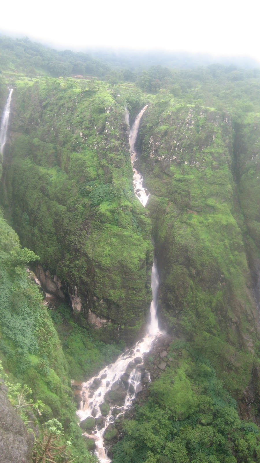 |
| Still not got full picture.Half of this waterfall is still falling in valley which could not be picturized due to fog.Just dared to look below on the edge and take photograph |
 |
| There was fog below us hence visibility of valley was less while reaching top |

 |
| Waterfalls , huge valleys and Bhimashankar, Ghonemaal Plateau Damdamia seen behind in fog |


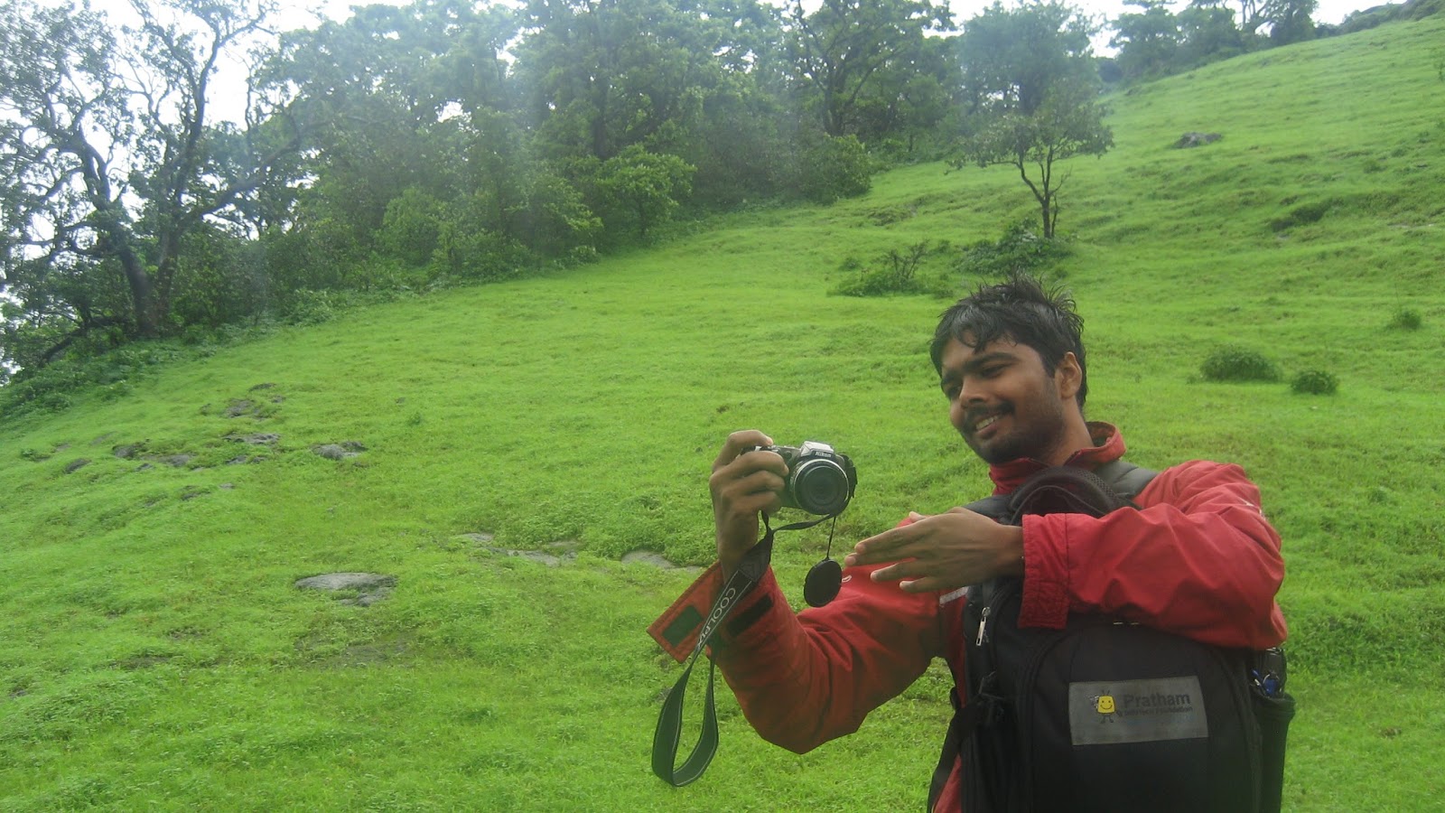 |
| Mahesh |
 |
| Approaching Topmost Point |


 |
| Towards Topmost Point |

 |
| Gorakhgad and Machhindragad below in the valley and view of Konkan |
 |
| Rice fields in Ahupe Village.We also saw how people were catching crabs in rice fields |
 |
| Ahupe Temple just near the entrance of village |
 |
| Ahupe Temple.A good place for staying for around 4 people |
 |
| Ahupe Village entrance |
 |
| Near Ahupe Gram daivat Temple.A small temple in forests |
 |
| Cloudy in the valley |
 |
| Towards the topmost narrow point.deep valley in Konkan |
 |
| Durg and Dhakoba seen far ahead from Ahupe top |
 |
| Waterfalls in valley with Damdamia and Bhimashankar lost in fog |
 |
| House in Ahupe. We were greeted with cup of tea |
 |
| Gigantic Waterfall falling into Konkan |


